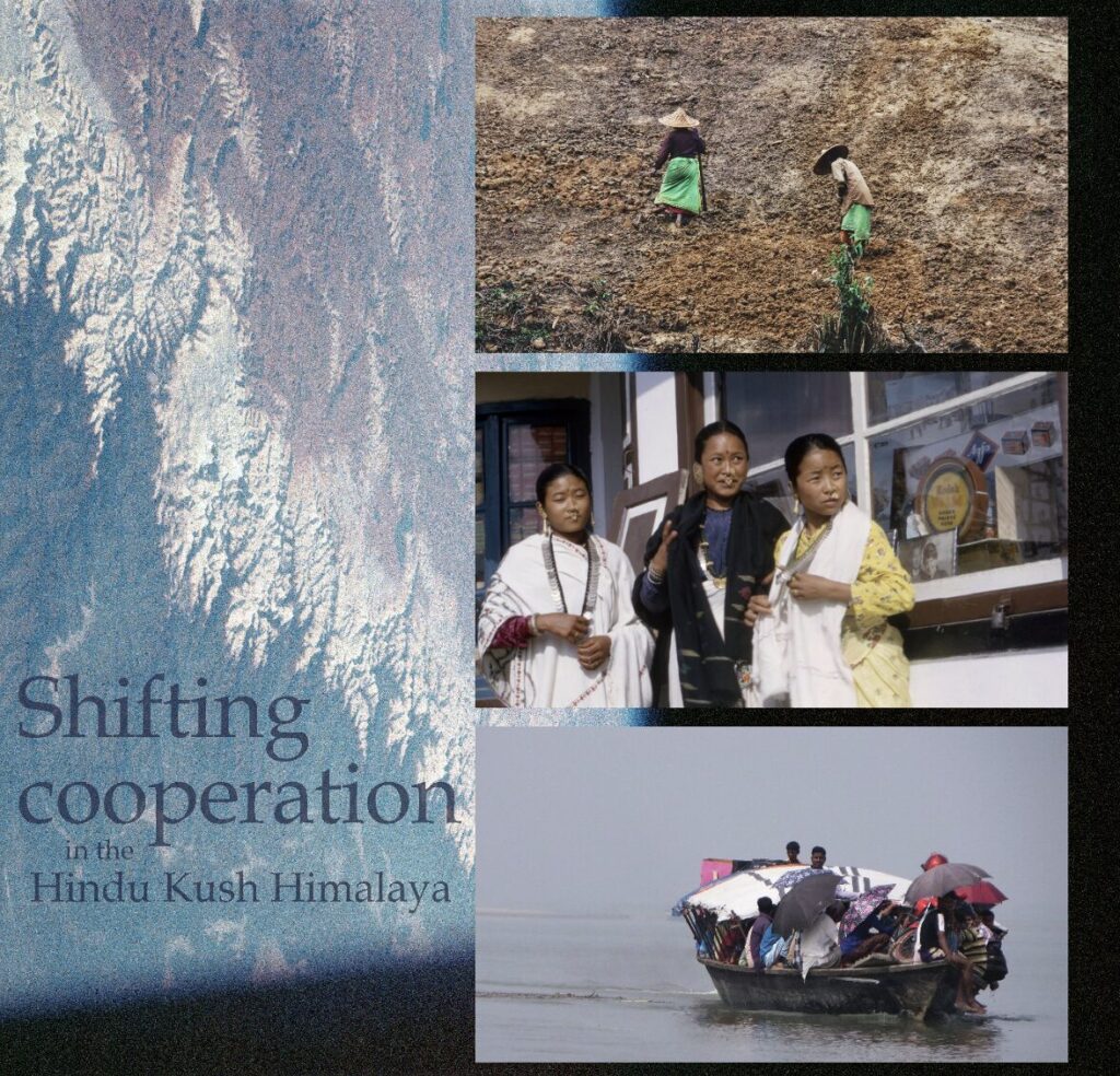
Shifting cooperation in the Hindu Kush Himalaya
Introduction
This article represents a communications experiment. As such, a few words are in order about its origins.
The idea was the brainchild of Adam Iveson, who worked as an intern at the Stockholm Environment Institute (SEI) Oxford Centre in the summer of 2023 while preparing to begin a master’s programme in Social and Public Communication at the London School of Economics and Political Science. Adam expressed an interest in experimenting with ways of engaging audiences on complex topics around climate change risk. SEI was willing to try something new.
The result is “Shifting Cooperation in the Hindu Kush Himalaya”. The piece is a decided departure from the style of academic research papers and policy briefs – the classic publications that are the essential communication tools of scientists and research institutions.
Adam’s article has links to strands of SEI’s work in the Hindu Kush Himalaya region through partners in the Adaptation at Altitude programme and through collaboration with the International Centre for Integrated Mountain Development as part of the Adaptation Without Borders global partnership. Indeed, cooperation in the region is a common theme of our policy engagement and research, which includes efforts to design a new, regional cooperation mechanism to build resilience to cross-border climate change risks. Adam did not travel to the region (not for lack of wanting!) but based his research on written sources, which are listed in the Bibliography at the end of this piece.
The piece is far from the first to observe that the Hindu Kush Himalaya is a deeply complex, beautiful, rich and strategically vital character in the world’s story about climate change. Indeed, these are the defining characteristics that lend themselves to new interpretations and out-of-the-ordinary story-telling concepts used in this piece. Readers will encounter freer use of language and form in this piece. The approach is a deliberate attempt to leave space for readers to connect their own dots…
We hope you enjoy Adam’s article and that it piques your interest to learn more about the region and wider work to support cooperation there.
Shifting cooperation in the Hindu Kush Himalaya
Interdependencies emerge from globalisation. Yet the extent to which interdependence shifts cooperation is a story less told.
As states look to build resilience to accelerating climate risks, so do individuals and communities, yet gulfs lie between their systems, their powers, and their goals – cooperation is central to the well-being of both. It exists in the acts of individuals, the livelihoods they have built together, and the continuous work to build sustainable infrastructure. This piece will explore cooperation through four examples from the Hindu Kush Himalaya which illustrate the complexity of interdependencies in the region and the implications for the wider world.
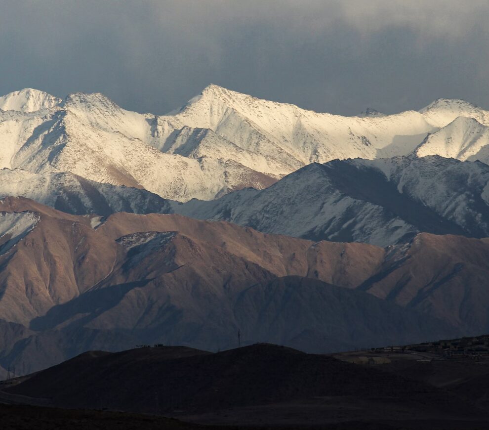
The globe’s “third pole” plays a huge role in regulating our climate. Its waters irrigate the lives of over 2 billion people. Its lands span 13 states, giving home to over 250 million. These communities have direct knowing and longstanding relationships with the mountains’ character. But coordination in the region can be fraught. Rising ambitions meet at their peaks. The stakes for regional cooperation couldn’t be higher. Colossal forces in this mountain range mean changes are inevitable, unavoidable. Shifts in cooperation, by contrast, are merely possible.
The Surface
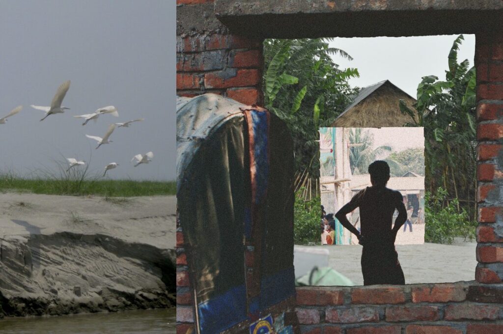
The Yarlung Tsangpo River originates on the Tibetan Plateau, becoming the Brahmaputra as it cascades into northern India, the Jamuna in Bangladesh, and finally meeting the Ganges, to complete its passage to the ocean. Himalayan erosions amass, drifting with the water, falling and folding. Caught. Held. Together forming banks and braids known as chars. From the water, turned to soil and ford – supporting plants and structure. Though unstable, communities monitoring these accretions continue to build homes and communities on their emergent surfaces. Some chars last for decades, others are drawn back into the depths. When the floods arrive, communities move to higher and more stable ground – wondering when and where the land will return.
Char communities have been shaped by these shifting lands. Aman and aus rice are intercropped to vary the crops’ flood vulnerability. When early monsoons threaten flooding, taller and older seedlings are replanted on lower grounds, while the more vulnerable are raised. Off-season crops like lentils, pulses, mustard and wheat are picked and passed on to fit the elevation and salinity of the river. Raised houses are built that can collapse and be packed onto boats as the waters rise. Rehoming on new land. When the floods come, kinship and social networks throughout the chars offer crisis relief, short-term housing, and opportunity for work in cities. Migration for urban labour is a common strategy to cope with strong flood seasons. Day wages help to supplement seasonal crop disruption, with remittances going back to families and flood repair.
This culture has produced a consistency in constant change, modifying and conforming to the river’s will. And yet, sediment and river flows seem to have forgotten their routines and rhythms. Monsoon rains untethered. Family and community-disturbing floods are amassing, seasons shifting. Topsoil is missing, gone with the trees cut down upstream. Runoff is rising. In the expanding uncertainty, pathways emerge – corridors of threat and opportunity.
Urban migration offers insurance impossible on the chars. Concrete and metal are bolted and moulded to the earth. Men and boys, arriving earlier and staying longer. Women and families on the chars are sent wages to help with taught resources. A father on foreign land, detached. But the younger man is grasping the surfaces, accepting the land. Arriving earlier and staying longer.
Remittance becomes a source of stability for households. Agricultural self-resilience is no longer the only option. Capacity to react to the rivers will, the reason for listening, wanes. Kinship ties and social threads pinning to distant surfaces. Emerge and return.
The Drive
Declared as a ‘Gift to the Earth’ as part of the World Wide Fund for Nature’s (WWF) Living Planet Campaign, the Kanchenjunga Conservation Area (KCA) in eastern Nepal is a protected part of the wider Kanchenjunga landscape which flows through Bhutan and India. Nearly three-quarters of the inhabitants in and around the protected areas live on roughly $2 a day. Livelihoods and communities are dependent on Kanchenjunga’s natural resources; food and fodder; cultural and religious connection; soil formation and water cycles; and the regulation of climate. Sustaining natural resources in these areas is therefore vital to local communities: benefits which reflect outwards beyond Kanchenjunga, and beyond Nepal.
Until 2012, protected areas within the Kanchenjunga landscape had been limited to isolated islands and corridors. These protected areas focused on species and ecosystem conservation, without taking into account social, political, or economic complexities. Conservation islands limit the ability for biodiversity to migrate freely, threatening species and often leading to human-nature conflict. The ability to migrate is vital as climates begin to shift and species are forced to search for sustaining lands. This has led to the development of landscape approaches that strive to integrate working lands and biodiversity.
Since 1997, WWF Nepal has invested over $1.5 million in KCA on several programs aimed at building capacity and protection into local communities. In its 2018 retrospective report, the WWF stated that forest and pastureland management has “helped to establish 27 community forests (…) which cover over 72,000 ha (…) benefiting the entire 1,257 households of the KCA”.
Yet these landscapes are still under threat from agricultural practices which deplete and destroy forests. “Slash-and-burn” has become rife due to population increase. This reduces long term soil fertility, harms biodiversity, and increases landslides. In trying to protect this area from degradation, regional government actors have come together with local community leaders to pass on sustainable knowledge and promote local community practices. Teaching and developing sustainable agroforestry will further biodiversity, increasing the sustainability and resilience of natural systems. These agricultural developments can help see that harmful slash-and-burn practices are left behind, to help preserve this pristine and sacred landscape.
However, there continues to be resistance to change from certain communities.
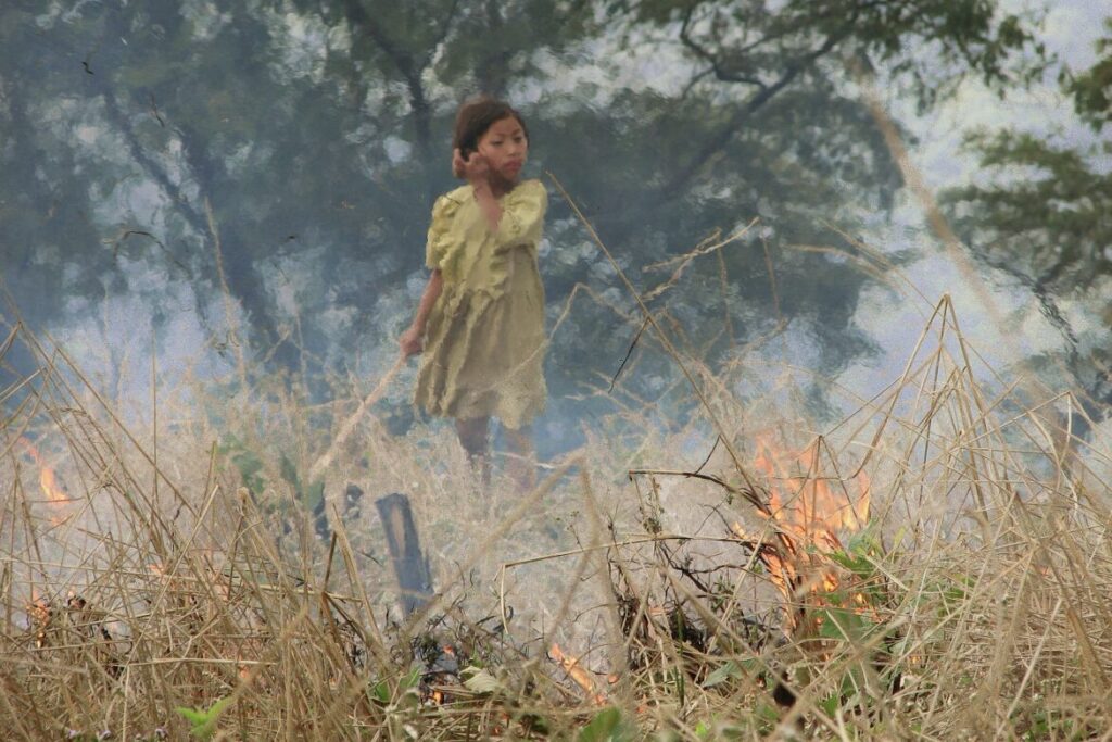
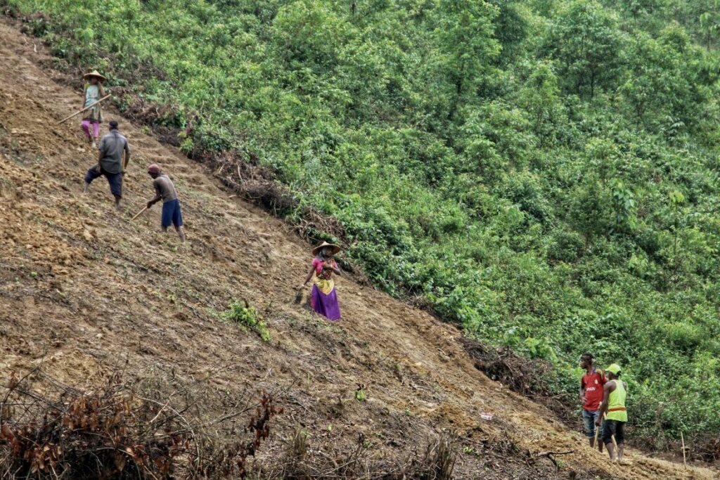
On the hillsides of eastern Nepal, a number of communities practise bhasme (or khoriya). This cyclical agricultural practice is centred on the cultivation of forests. By cycling cropping fields and forests these communities are able to retain soil nutrients. The sloping terrain has particularly high runoff and infrequent yet notably dense rainfall. This means vegetation forms the major nutrient stores of the land. After short cropping cycles the soil is degraded as vegetation is removed from the system. Crop yields begin to fall. Bhasme-reliant communities must sustain the earth’s long-term health for their own well-being, and so they allow it to rest.
Fallow fields ‘overgrow’ so natural ecosystem processes can re-nourish the land. Organic matter layers and fertilises the soil. New trees give the slopes structure, limiting the threat of erosion. The forest supplies firewood, bamboo and medicinal plants, whilst cleared fields are used to grow fruit and vegetables. Biodiversity flourishes, given human intervention and agricultural monoculture is at a minimum. The farmers themselves are cultivating, fallowing, and burning different sections of land, creating patchwork corridors for the migration of animals and vegetation.
After 15 to 30 years, the land has regrown its large nutrient store. Farmers can begin to prepare the land for cultivation once more. Vegetation is cut and left to dry for some weeks. Mother trees are left where possible, keeping structure in the soil and helping regeneration. To reduce the risk of wildfire, the wider community is gathered, weather conditions consulted. Dried vegetation is laid low or under thin soil, decreasing flames and nutrient loss. Perimeters dug to contain the spread. In the burn, weeds are destroyed and soil-borne pests are removed. Seeds are then smeared with ash and sown to mask them from birds.
Bhasme is externally simplified to be the practice of destroying forests, yet it is dependent on their growth. Development organisations and the government note how population increase and other pressures are reducing the time and space for restful fallow and regrowth. Work is being done to remove bhasme practices via the imposition of legal barriers. The drive to survey Kanchenjunga forest lands has led to the miscategorisation of fallowed areas as “uncultivated forests”. Focus is placed on forest protection which removes the rights of farming communities and imposes fines on their cultivation. Bhasme communities are thus driven into smaller areas, shortening the agricultural cycles which are vital for the regeneration of the earth, speeding soil degradation, and reducing forest cover. Despite this, the communities’ dependence on these lands and practices endures; bhasme continues to sustain livelihoods across the region.
The Cascade
“They target us because they are ********”
Few would have predicted the invasion of Ukraine by Russian military in late February 2022. Media services attempted to get a handle on events as handheld footage surfaced – convoys of helicopters and tanks through smoke, missile strikes an airport. Southeastern Ukraine was a target, Donetsk and Mariupol. Grain.
“…And because we feed the world.”
Source: The Guardian (2023)
The world depends on the trade of grain and crude oil. Pipelines, shipping corridors, freight. Land and seas webbed with exchange. Nourishment and power pinned to distant surfaces. Taught cords plucked, tremor.
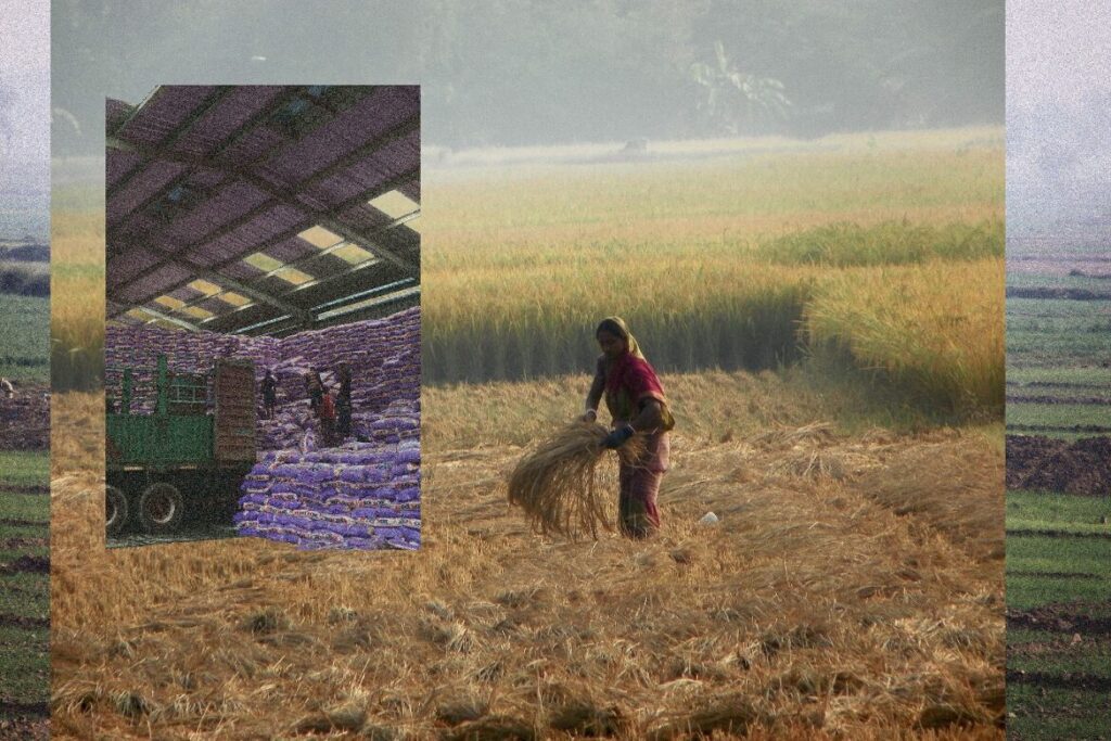
Mid-March 2022, India: temperatures soar in northern agricultural regions parching the soil and depleting crop yields. As Ukrainian grain exports plummet, Indian inflation hits an eight-year high. Government officials in India boast of record wheat exports to come, yet days later announce export restrictions to limit inflation and cover national needs. Prices begin to stabilise with the Black Sea Grain Initiative in late July. Rice-sowing season is closing in West Bengal, Bihar, Punjab, and Uttar Pradesh. These four regions can account for half of India’s rice crop. Over 20 million tonnes exported a year.
Pressure from months of inflating food prices across 2007 and into 2008 finally gave way to outrage in Senegal. Street vendors protesting development laws are joined by thousands throughout Dakar. “We Are Hungry”. Government reactions further obstruct dialogue. Stones through smoke and gas. In Dakar, 20-25% of an average wage is spent on rice, in large part broken rice. Of the 75% which is imported, more than half is from India. Reducing Senegal’s rice import dependency has been a major development policy for over a decade.
“We are tired. Today, I cannot eat because I haven’t sold anything… That’s why everyone wants to go to Europe.”
Reuters (2007)
June to November 2022, average rainfall in India is up. Yet these levels are heavily inflated by excess rains in the final weeks of September. In the northern regions bordering the Himalayas, drought has continued to starve the soil. To protect national markets, India introduces a 20% export tax on rice, with a full ban on export of broken rice, as of September 8th, 2022. Cords plucked. Tremor.
The Exchange
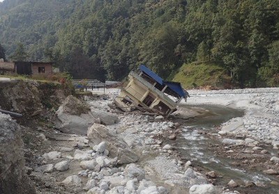
The Sivalik (Churia) hills span the southern boundaries of the Himalayas from the Indus to the Brahmaputra. Built from silt and sand, solidified detritus. Soft hills have succumbed to the river’s torrent, carved to steep valleys. Dense monsoon makes flooding routine. Yet, floodplains are built upon. Land destabilised by loss of structuring trees, silt accumulating. Strengthening monsoons compound flooding. Thousands are lost in these swells as they sweep through Nepal, decade by decade. In 2022, rain was falling in the hills, building in the Ratu River.
Northeast by 30km, the Tama Koshi valleys are fed from the Tsho Rolpa Lake. Throughout the 1990s glacial melt threatened to crest the end moraine, threatening to flood the towns and villages downstream. In 1997 the Nepalese Government commissioned a Canadian company to design and install an early warning system for the towns and villages of the area. Nineteen warning and relay stations were installed. They included state of the art transceivers, antennae, solar panels, and air horns, all built with galvanised steel, comfortable in the harshest weather the Himalayas could muster. A meteor burst station used the ionised trails of falling asteroids to extend the range of transmittance to 1,600km allowing each remote system to be monitored from Kathmandu. On the ground, the system was fully automated, requesting no exchange. A total cost of just over $1 million. Within four years the system was no longer operational.
The system had been ignored, then dismantled or destroyed. Distrust of political and international power bloomed when locals talked of the investment into the system.
Why would they pay so much for our safety when they won’t invest in schools, healthcare, and other infrastructure in the area? The value of mountain resources, mining.
Scepticism was compounded by the lack of local participation in the project. And the false alarms. Locals repurposed the equipment for their own projects.
Monsoon rains are now picking up mud, silt, stones, and debris on their course down the Ratu. The swell tears through Kalapani stealing concrete and metal for its procession. Lalgahd and Sarapallo come next. Houses turned to islands. A season’s agriculture drowned and uprooted. But something is different. Surging into the plains of Shrikhandi Bhitha, northern India, inundating thousands more homes, farms, and families. Yet, no one is caught by the swell.
In 2015, receivers and transmitters were installed along the Nepalese stretch of the Ratu. The receivers were placed in the houses of caretakers, community volunteers tasked to monitor the transmitters’ readings. If a flood is threatening or on its way, they are to get word to the surrounding communities. Sirens and SMS. Social networks, shopkeepers, neighbours. All employed to transmit warnings. The system’s success led policymakers to extend transmission downriver and into India. Warnings shared.
As of 2021, each instalment costs roughly $3,500. With yearly maintenance; including caretaker remuneration and communication cost, community workshops, and spare parts totalling roughly $1,000 a year.
Short warning windows mean little can be saved in flash floods. River flow systems are complex – small rivers particularly unreliable. Vast areas of agricultural lands are lost every year to flooding. Livelihoods uprooted leading to increased seasonal migration and increased strain on women throughout flood season. These early warning systems work as adaptations, not solutions.
In the development of this system, local communities were consulted at each stage. Local knowledge of flood intensity was used to calibrate alert thresholds. The warnings use communication pathways which suit the local community’s character. Trust is built as social networks connect to focal individuals and community organisations – in return communicating feedback to local government institutions. Equipment is maintained as communities take responsibility for the reliability and functioning of their systems. Webbed exchange holding.
The Bind
Cooperation is reflective of its actors. Their incentives, knowledge, and power drive the exchange. States, communities and families are attempting to withstand and adapt to shifts beyond their own scale. Shifts that reveal a web of interdependence. This web tremors and destabilises – yet it binds and incentivises. Shifting cooperation.
The Hindu Kush Himalaya region warrants global attention. Climate shifts here drive cascades that will distort reality for billions of people. The nature and ambition of cooperation here will shape the world below and beyond.
Threads tremor. Surfaces emerge and return. And we are bound by each of them.
Acknowledgements:
I would like to say a huge thank you to the team at SEI Oxford who supported my work, answered my questions, and let me sit in on their conversations. In particular a hearty Thank You to Estelle Lorang, who helped me conceptualise much of the piece throughout the 7 weeks of my internship, and to Magnus Benzie, whose insights and patience throughout carried much of the work.
Further resources
Enhancing cooperation to address cascading climate risks in the Hindu Kush Himalaya

Cascading Climate Impacts – Policy Simulation

Transboundary Impacts of Climate Change in Asia: Making a Case for Regional Adaptation Planning and Cooperation
Comments
There is no contentYou must be logged in to reply.